


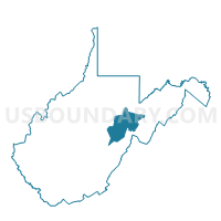
Voting District 220, Randolph County, West Virginia
About
Outline

Summary
| Unique Area Identifier | 691834 |
| Name | Voting District 220 |
| County | Randolph County |
| State | West Virginia |
| Area (square miles) | 71.85 |
| Land Area (square miles) | 71.84 |
| Water Area (square miles) | 0.01 |
| % of Land Area | 99.98 |
| % of Water Area | 0.02 |
| Latitude of the Internal Point | 38.67184100 |
| Longtitude of the Internal Point | -80.17563530 |
Maps


Graphs
Select a template below for downloading or customizing gragh for Voting District 220, Randolph County, West Virginia


Neighbors
Neighoring Voting District (by Name) Neighboring Voting District on the Map
- Voting District 2, Webster County, WV
- Voting District 215, Randolph County, WV
- Voting District 225, Randolph County, WV
- Voting District 24, Webster County, WV
- Voting District 29, Webster County, WV
- Voting District 4, Upshur County, WV
- Voting District 47, Upshur County, WV
- Voting District 7, Upshur County, WV
Top 10 Neighboring County Subdivision (by Population) Neighboring County Subdivision on the Map
- Third district, Upshur County, WV (8,355)
- Second district, Upshur County, WV (8,296)
- Huttonsville district, Randolph County, WV (3,311)
- Northern district, Webster County, WV (2,575)
- Mingo district, Randolph County, WV (794)
- Middle Fork district, Randolph County, WV (728)
Top 10 Neighboring Place (by Population) Neighboring Place on the Map
Top 10 Neighboring Unified School District (by Population) Neighboring Unified School District on the Map
- Randolph County School District, WV (29,405)
- Upshur County School District, WV (24,254)
- Webster County School District, WV (9,154)
Top 10 Neighboring State Legislative District Lower Chamber (by Population) Neighboring State Legislative District Lower Chamber on the Map
- State House District 37, WV (38,124)
- State House District 39, WV (19,304)
- State House District 38, WV (17,592)
- State House District 36, WV (15,931)
Top 10 Neighboring State Legislative District Upper Chamber (by Population) Neighboring State Legislative District Upper Chamber on the Map
Top 10 Neighboring 111th Congressional District (by Population) Neighboring 111th Congressional District on the Map
Top 10 Neighboring Census Tract (by Population) Neighboring Census Tract on the Map
- Census Tract 9670, Upshur County, WV (4,920)
- Census Tract 9701, Webster County, WV (4,742)
- Census Tract 9665, Randolph County, WV (4,558)
- Census Tract 9671, Upshur County, WV (4,515)
- Census Tract 9659, Randolph County, WV (4,053)
- Census Tract 9702, Webster County, WV (2,143)
Top 10 Neighboring 5-Digit ZIP Code Tabulation Area (by Population) Neighboring 5-Digit ZIP Code Tabulation Area on the Map
- 26288, WV (3,603)
- 26218, WV (2,583)
- 26273, WV (2,041)
- 26280, WV (1,710)
- 26234, WV (1,454)
- 26222, WV (454)
- 26224, WV (221)
- 26230, WV (124)
- 26282, WV (60)
- 26236, WV (29)